Civil Services Examination · प्रश्न 19
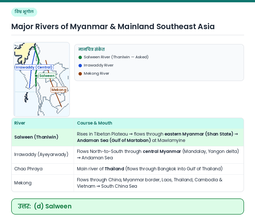
The river shown on the map is

उत्तर देखें और व्याख्याव्याख्या देखें
उत्तर: (D) Salween
Concept: Myanmar's two principal north-south river systems are the central Irrawaddy (Ayeyarwady) and the eastern Salween (Thanlwin). Map Identification: The river plotted on the map flows along the eastern part of Myanmar (through the Shan Plateau and Kayin/Mon states) and empties into the Gulf of Martaban (Andaman Sea) near Mawlamyine ⇒ this is the Salween River. Result: The river shown on the map is the Salween. Related Facts: • Origin: Both the Salween (Nu Jiang in China) and the Mekong originate on the Tibetan Plateau. • Border Segment: A stretch of the lower Salween forms the international boundary between Myanmar and Thailand. सही उत्तर: (d) Salween