Civil Services Examination · प्रश्न 38
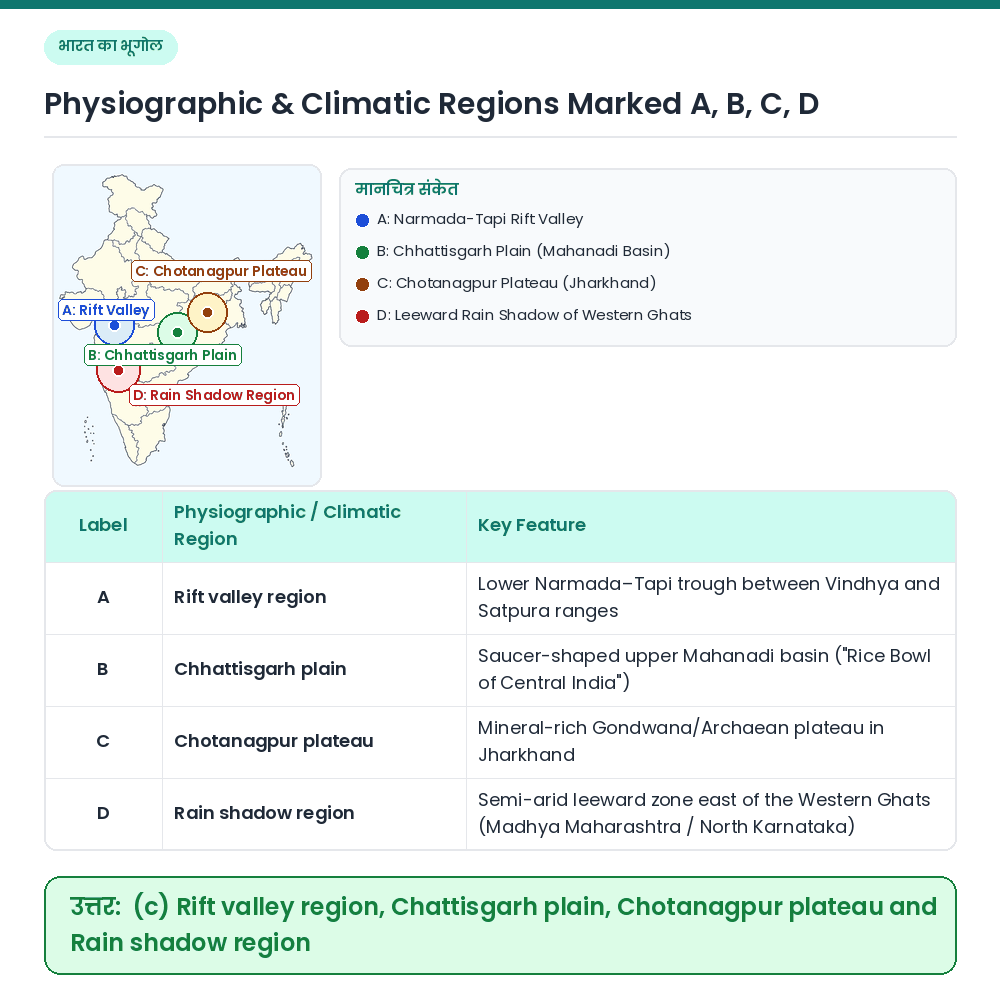
Consider the map given below: The places marked A, B, C and D in the map are respectively

उत्तर देखें और व्याख्याव्याख्या देखें
उत्तर: (C) Rift valley region, Chattisgarh plain, Chotanagpur plateau and Rain shadow region
Concept: Peninsular India comprises structural rift valleys, interior river basins, mineral plateaus, and orographic rain-shadow belts. Identifying Regions A to D on the Map: • A (Lower Narmada–Tapi belt in Gujarat/MP) ⇒ Rift valley region. • B (Upper Mahanadi basin in central-east India) ⇒ Chhattisgarh plain. • C (Jharkhand highland east of Chhattisgarh) ⇒ Chotanagpur plateau. • D (Leeward strip immediately east of the Western Ghats crest) ⇒ Rain shadow region. Result: A, B, C and D are respectively Rift valley region, Chhattisgarh plain, Chotanagpur plateau and Rain shadow region. Related Facts: • West-Flowing Rift Rivers: Narmada and Tapi flow westward into the Arabian Sea through faulted grabens (rift valleys). • Ruhr of India: The Chotanagpur Plateau (Damodar Valley) is known as the 'Ruhr of India' for its rich coal and iron-ore reserves. सही उत्तर: (c) Rift valley region, Chattisgarh plain, Chotanagpur plateau and Rain shadow region