Civil Services Examination · प्रश्न 85
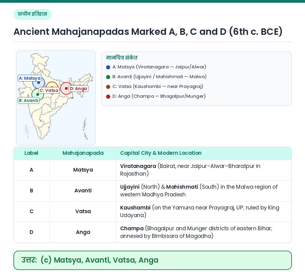
The following map shows four of the sixteen mahajanapadas that existed in ancient India: The places marked A, B, C and D respectively are

उत्तर देखें और व्याख्याव्याख्या देखें
उत्तर: (C) Matsya, Avanti, Vatsa, Anga
Concept: According to the Buddhist text Anguttara Nikaya and Jaina text Bhagavati Sutra, sixteen great kingdoms/oligarchies (Solasa Mahajanapadas) flourished in 6th century BCE India. Identifying A, B, C and D on the Map: • A (Eastern Rajasthan around Jaipur/Bairat) ⇒ Matsya (capital: Viratanagara). • B (Malwa plateau in western MP) ⇒ Avanti (capitals: Ujjayini and Mahishmati). • C (Lower Ganga-Yamuna Doab near Prayagraj) ⇒ Vatsa (capital: Kaushambi). • D (Easternmost Mahajanapada in Bhagalpur/Munger, Bihar) ⇒ Anga (capital: Champa). Result: The places A, B, C and D are Matsya, Avanti, Vatsa, Anga. Related Facts: • Southernmost Mahajanapada: Assaka (Ashmaka, capital Potana/Paithan) on the banks of the Godavari was the only Mahajanapada south of the Vindhyas. • Republican (Gana-Sangha) Mahajanapadas: Vajji (Vaishali) and Malla (Kushinagar & Pava). सही उत्तर: (c) Matsya, Avanti, Vatsa, Anga