Civil Services Examination · प्रश्न 53
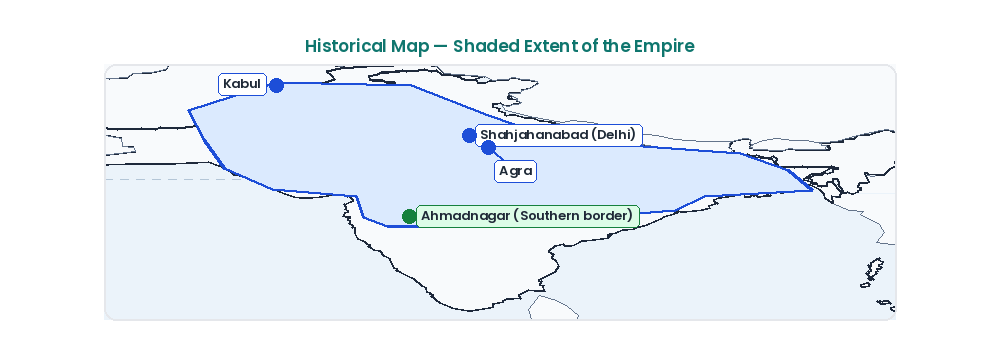
The shaded area in the above map shows the empire of
उत्तर देखें और व्याख्याव्याख्या देखें
उत्तर: (C) Shah Jahan
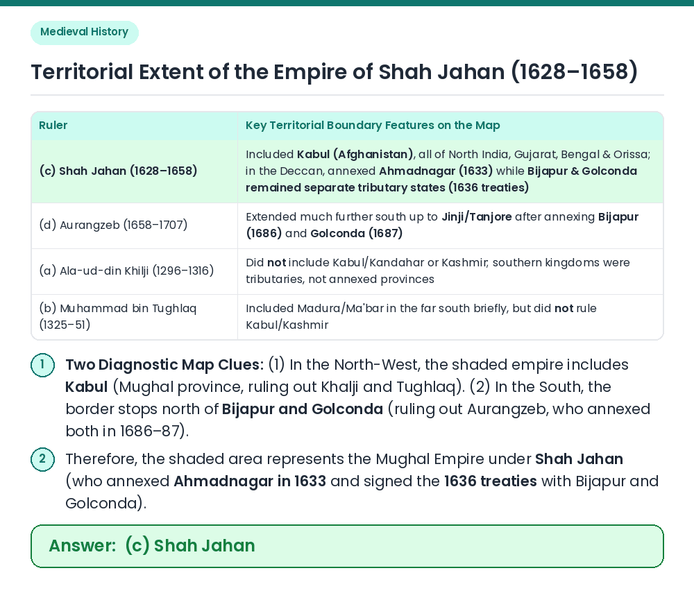
Analyze North-Western & Southern Boundaries: To identify a medieval Indian empire on a map, examine two key frontiers: (i) the North-West (Kabul/Kandahar and Kashmir) and (ii) the Deccan/Far South (south of the Krishna and Tungabhadra rivers). Compare the Four Rulers: ⇒ Neither Ala-ud-din Khilji nor Muhammad bin Tughlaq ruled over Kashmir and Kabul, proving the map depicts the Mughal Empire. ⇒ Between Shah Jahan and Aurangzeb, Aurangzeb annexed Bijapur (1686) and Golconda (1687), pushing the Mughal boundary deep into the Tamil country (almost to the southern tip of India). Under Shah Jahan (1628–1658), Ahmadnagar was annexed (1633) and Bijapur and Golconda accepted Mughal suzerainty under the 1636 treaties while remaining outside direct imperial boundary. Result: The shaded area in the map shows the empire of Shah Jahan. Related Facts: • Four Deccan Subahs under Shah Jahan: Khandesh, Berar, Telangana, and Daulatabad (Ahmadnagar), governed by Prince Aurangzeb as Viceroy of the Deccan. • Balkh & Badakhshan Campaign (1646–47): Shah Jahan launched the famous Central Asian campaign to recover the Timurid ancestral homeland, while Kandahar was permanently lost to Safavid Persia in 1649. सही उत्तर: (c) Shah Jahan