SSC CGL – Combined Graduate Level Examination · Question 35
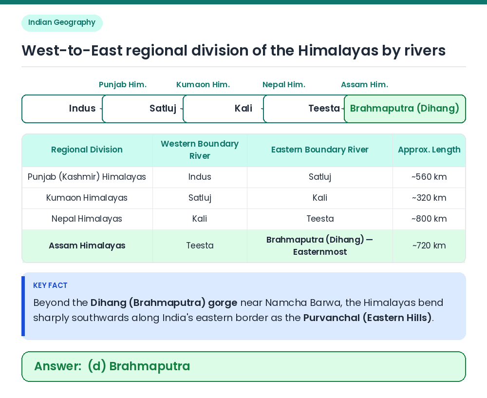
Which of the following rivers marks the eastern-most boundary of the Himalayas?
Show answer & explanationShow explanation
Answer: (D) Brahmaputra
Identify the easternmost boundary: The Brahmaputra river (known as the Dihang as it enters Arunachal Pradesh around Namcha Barwa peak) forms a deep gorge and marks the easternmost boundary of the Himalayas. • Key Fact 1: Beyond the Dihang gorge, the mountains bend sharply to the south (syntaxial bend) along the eastern boundary of India and are known as the Purvanchal or Eastern Hills (Patkai Bum, Naga Hills, Manipur Hills, Mizo Hills). • Key Fact 2: By Sir Sidney Burrard's river-valley demarcation from west to east: Indus to Satluj = Punjab Himalayas; Satluj to Kali = Kumaon Himalayas; Kali to Teesta = Nepal Himalayas; Teesta to Dihang/Brahmaputra = Assam Himalayas. Correct Answer: (d) Brahmaputra