Civil Services Examination · Question 29
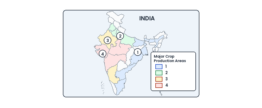
In the map given below four areas are differently shaded, three of which indicate cereal crops production areas and one indicates non-cereal crop production area. As per the index given, the non-cereal crop production area is
Show answer & explanationShow explanation
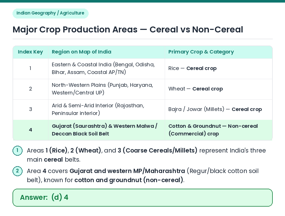
Answer: (D) 4
Identify 1, 2, 3: On the crop distribution map of India, shaded area 1 covers the eastern and coastal belt (Rice), area 2 covers the Indo-Gangetic northwestern plains (Wheat), and area 3 covers the dry western/peninsular zone (Bajra/Jowar millets)—all three are cereal crops. Identify 4: Shaded area 4 covers Gujarat (Kathiawar/Saurashtra) and adjacent western Madhya Pradesh/Maharashtra, which is the primary belt for non-cereal commercial crops (Cotton and Groundnut). Verify: Therefore, index 4 represents the non-cereal crop production area. Result: The non-cereal crop production area is marked 4. Related Facts: • Black cotton soil (Regur) in the Deccan Trap region of Gujarat and Maharashtra is ideal for cotton cultivation. Correct Answer: (d) 4