Civil Services Examination · Question 68
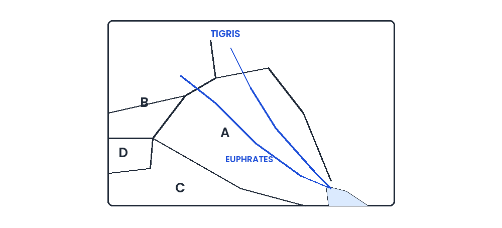
The rough outline map shows a portion of the Middle East. The countries labelled A, B, C and D are respectively
Show answer & explanationShow explanation
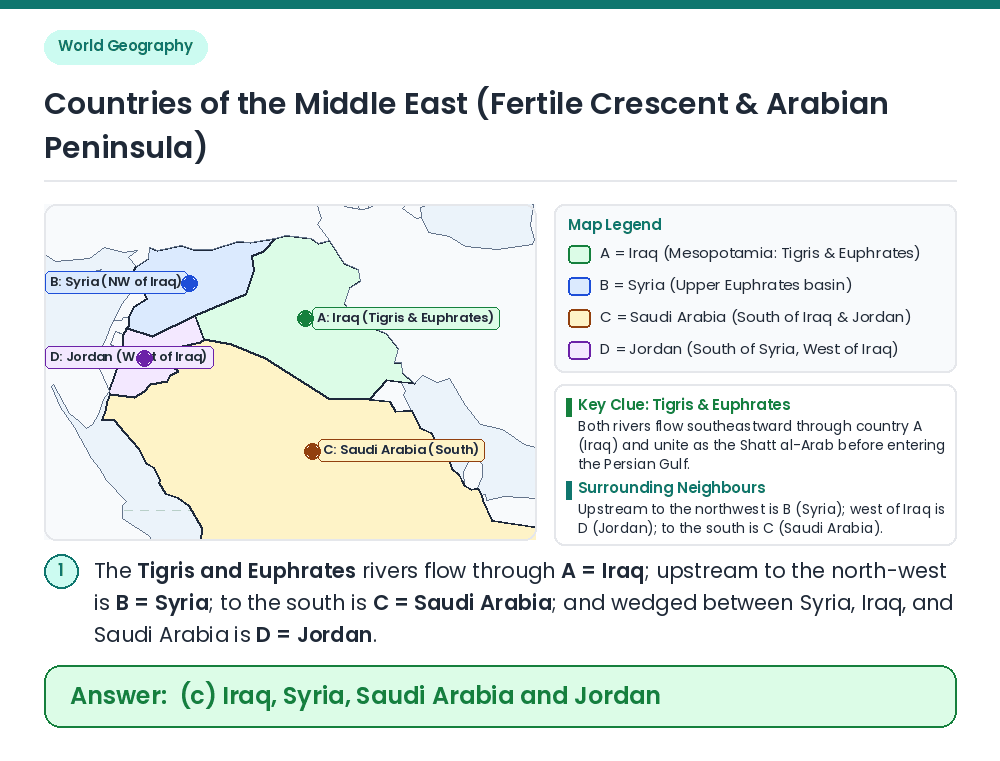
Answer: (C) Iraq, Syria, Saudi Arabia and Jordan
Concept: Use the courses of the Tigris and Euphrates rivers and relative political boundaries to identify countries A, B, C, and D in West Asia (the Middle East). Identify A & B from River Courses: ⇒ The Tigris and Euphrates rivers flow across the Mesopotamian plain and converge in country A before emptying into the Persian Gulf — hence A is Iraq. The Euphrates enters Iraq from its northwestern neighbour B — hence B is Syria. Identify C & D: ⇒ The large country lying south of both Iraq and Jordan is C = Saudi Arabia, while the smaller country lying south of Syria and west of Iraq is D = Jordan. Result: The countries labelled A, B, C, and D are Iraq, Syria, Saudi Arabia and Jordan respectively. Related Facts: • Shatt al-Arab: The Tigris and Euphrates rivers join at Al-Qurnah in southern Iraq to form the Shatt al-Arab waterway, which empties into the Persian Gulf. Correct Answer: (c) Iraq, Syria, Saudi Arabia and Jordan