Civil Services Examination · Question 85
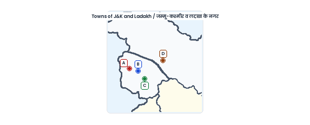
In the rough outline map of a part of Jammu and Kashmir shown in the figure, places marked A, B, C and D represent respectively
Show answer & explanationShow explanation
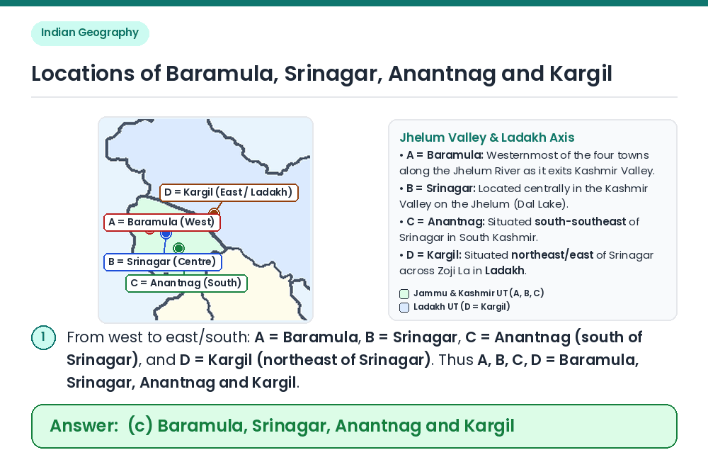
Answer: (C) Baramula, Srinagar, Anantnag and Kargil
Concept: Determine the relative geographical coordinates of Baramula, Srinagar, Anantnag, and Kargil along the Jhelum Valley and NH-1 (Srinagar–Leh highway). Identify A, B, and C in Kashmir Valley: Flowing northwestward through the Kashmir Valley, the Jhelum passes Anantnag in the south (C: 33.73°N, 75.15°E), Srinagar in the centre (B: 34.08°N, 74.80°E), and Baramula further west (A: 34.20°N, 74.34°E). Identify D in Ladakh: Crossing the Zoji La pass to the northeast of Srinagar lies Kargil on the Suru River (D: 34.56°N, 76.13°E). Result: Places A, B, C, and D represent Baramula, Srinagar, Anantnag, and Kargil respectively. Shortcut: Since D is the easternmost point (Kargil) and C is the southernmost point (Anantnag), only option (c) has C = Anantnag and D = Kargil. Correct Answer: (c) Baramula, Srinagar, Anantnag and Kargil