Civil Services Examination · Question 36
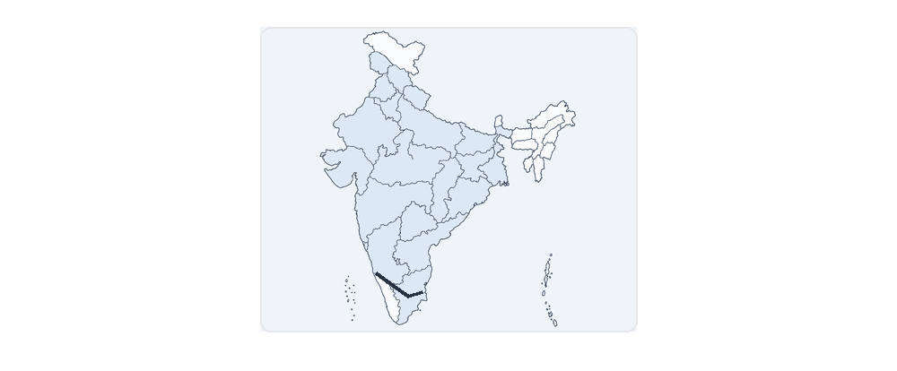
The given map refers to the kingdom of
Show answer & explanationShow explanation
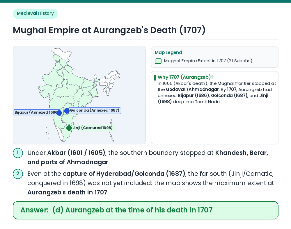
Answer: (D) Aurangzeb at the time of his death in 1707
Concept: Compare the territorial expansion of the Mughal Empire across the Deccan and South India between 1601 and 1707. Boundary Analysis: At Akbar's death in 1605, the Mughal Empire extended only up to the Godavari basin (Khandesh, Berar, and Ahmadnagar) ⇒ After annexing Bijapur (1686), Golconda/Hyderabad (1687), and Jinji in the Carnatic (1698), the empire reached its greatest territorial extent stretching almost to the southern tip of the peninsula (excluding only Travancore/Malabar tip and Ahom Assam). Result: The shaded map represents the empire of Aurangzeb at the time of his death in 1707. Related Facts: • Number of Subahs: The Mughal Empire had 15 Subahs under Akbar and 20–21 Subahs under Aurangzeb. • Death of Aurangzeb: Occurred on 3 March 1707 at Ahmadnagar, buried at Khuldabad. Correct Answer: (d) Aurangzeb at the time of his death in 1707