Civil Services Examination · Question 133
The approximate representation of land use classification in India is
Show answer & explanationShow explanation
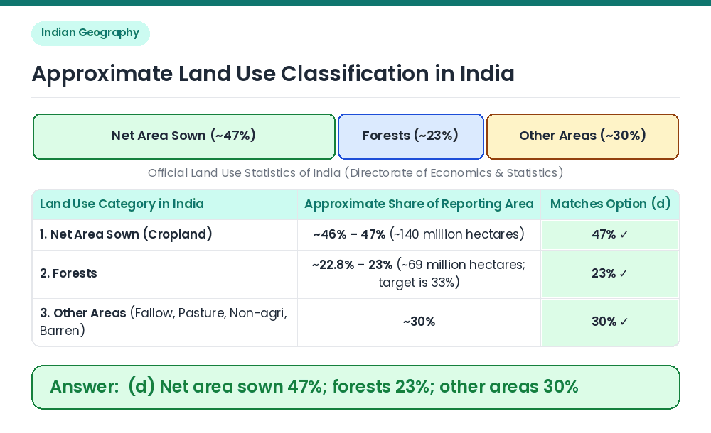
Answer: (D) Net area sown 47%; forests 23%; other areas 30%
Concept: Land use statistics in India are compiled by the Directorate of Economics and Statistics (Ministry of Agriculture) out of a total reporting area of ~305 million hectares. Actual Proportions: India has one of the highest proportions of arable cropland in the world, with Net Area Sown accounting for ~46%–47% (~140–141 million ha), Area under Forests accounting for ~22.8%–23% (~69–70 million ha, compared to the National Forest Policy target of 33%), and all other areas (fallow land, pastures, barren land, non-agricultural uses) accounting for ~30%. Result: Net area sown 47%; forests 23%; other areas 30% is the correct representation. Related Facts: • India's National Forest Policy (1952 and 1988) envisages bringing 33% (one-third) of the total geographical area under forest and tree cover (66% in hills and mountain regions). Correct Answer: (d) Net area sown 47%; forests 23%; other areas 30%