Civil Services Examination · Question 71
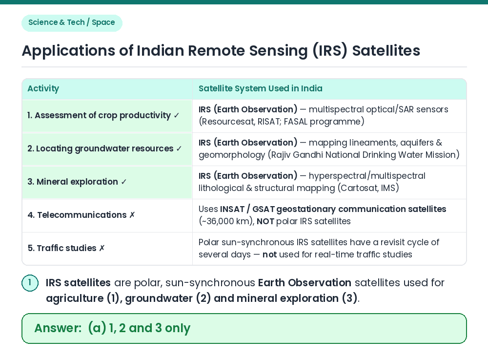
In which of the following activities are Indian Remote Sensing (IRS) satellites used? 1. Assessment of crop productivity 2. Locating groundwater resources 3. Mineral exploration 4. Telecommunications 5. Traffic studies Select the correct answer using the code given below.
Show answer & explanationShow explanation
Answer: (A) 1, 2 and 3 only
Concept: ISRO operates two distinct major satellite constellations — Indian Remote Sensing (IRS / EOS) satellites in Low-Earth Polar Sun-Synchronous Orbit (SSPO) for Earth observation, and INSAT/GSAT satellites in Geostationary Orbit (GSO) for communications and meteorology. Evaluate 1, 2 and 3: ⇒ IRS satellites (such as Resourcesat, Cartosat, Oceansat and RISAT) carry multispectral, panchromatic and radar sensors used for crop acreage and productivity assessment (1), hydrogeomorphological mapping to locate groundwater aquifers (2), and geological/mineral exploration (3) — 1, 2 and 3 are correct. Eliminate 4 and 5: ⇒ Telecommunications (4) is performed by geostationary INSAT/GSAT transponders, not IRS satellites; and real-time traffic flow studies (5) are not performed by polar-orbiting IRS earth-resource satellites. Conclusion: Activities 1, 2 and 3 only use Indian Remote Sensing (IRS) satellites. • Related Facts: India's first indigenous remote sensing satellite, IRS-1A, was launched on 17 March 1988. • Launch Vehicle: Polar Satellite Launch Vehicle (PSLV) is the workhorse rocket used to place IRS satellites into Sun-Synchronous Polar Orbit. Correct Answer: (a) 1, 2 and 3 only