Civil Services Examination · Question 23
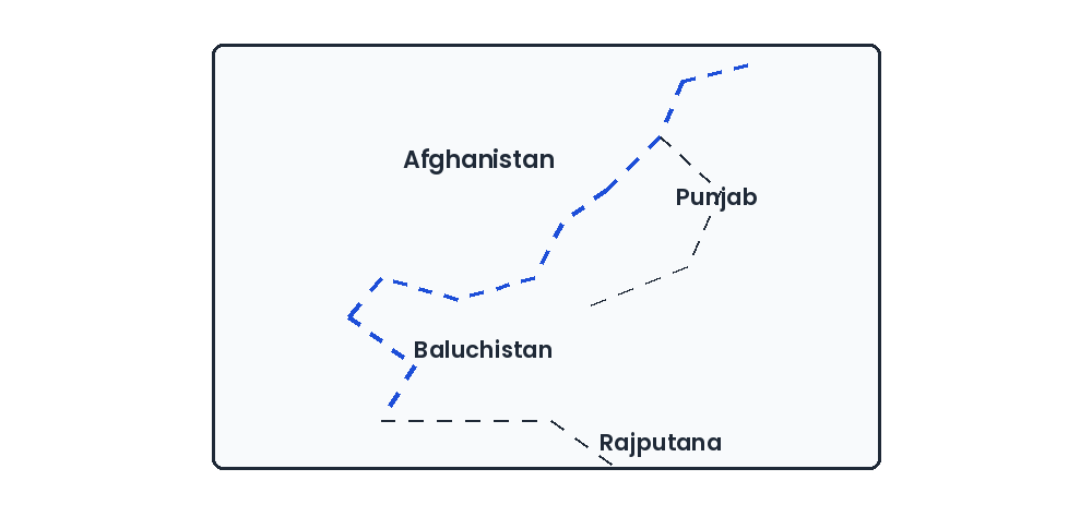
Consider the map given below: The dotted (broken) line in the map is the
Show answer & explanationShow explanation
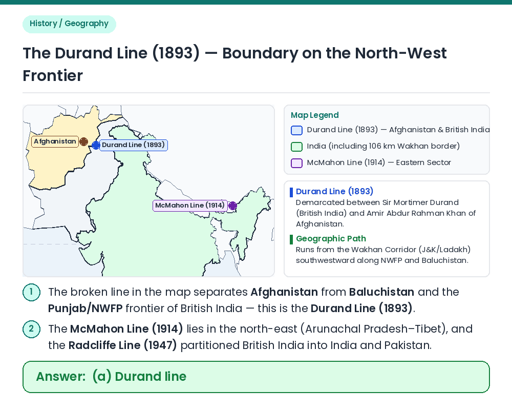
Answer: (A) Durand line
Concept: Identify the historical international boundary line depicted between Afghanistan and the north-western provinces (Baluchistan and Punjab/NWFP) of pre-1947 British India. Verify Map Labels: ⇒ The map explicitly shows the broken line running along the border between Afghanistan on the north-west and Baluchistan and Punjab on the south-east. Historical Agreement: ⇒ This boundary is the Durand Line, established on 12 November 1893 by an agreement between Sir Mortimer Durand (Foreign Secretary of British India) and Amir Abdur Rahman Khan (Ruler of Afghanistan) during the viceroyalty of Lord Lansdowne. Result: The dotted (broken) line in the map is the Durand line. Related Facts: • McMahon Line (1914): Negotiated by Sir Henry McMahon at the Simla Convention (1914) demarcating the boundary between India (Arunachal Pradesh) and Tibet. • Younghusband Expedition (1903–04): A British military mission to Lhasa (Tibet) led by Colonel Francis Younghusband during Lord Curzon's viceroyalty. Correct Answer: (a) Durand line