Civil Services Examination · Question 53
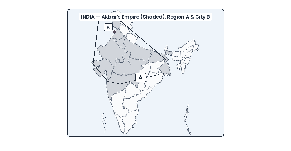
In the given map, the shaded part represents Akbar's empire at a certain juncture: 'A' stands for an independent country and 'B' marks the site of a city. Which one of the following alternatives gives all correct information?
Show answer & explanationShow explanation
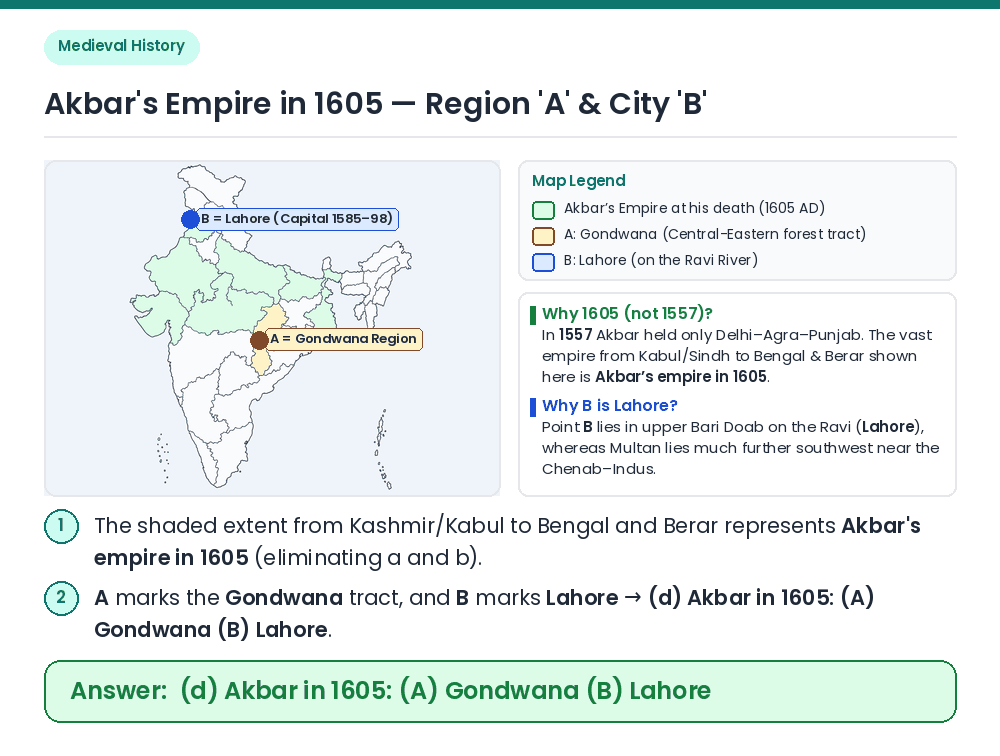
Answer: (D) Akbar in 1605: (A) Gondwana (B) Lahore
Given / Concept: Examine the territorial extent of the shaded empire on the map of India. Determine Year — 1557 vs. 1605: In 1557 (just one year after his accession and the Second Battle of Panipat), Akbar controlled only Punjab and the Delhi–Agra region; the vast empire stretching from Afghanistan and Sindh to Bengal and Berar/Ahmadnagar represents Akbar's empire at his death in 1605 (eliminating a and b). Identify A & B: Between (c) and (d), 'A' is Gondwana in both, and city 'B' in northern Punjab on the Ravi river is clearly Lahore (which served as Akbar's capital from 1585 to 1598), not Multan. Result: Option (d) gives all correct information: Akbar in 1605: (A) Gondwana (B) Lahore. Related Facts: • 15 Subahs of Akbar: By 1605, Akbar's empire was divided into 12 original Subahs plus 3 Deccan Subahs (Berar, Khandesh/Dandesh, and Ahmadnagar). • Conquest of Garha-Katanga (Gondwana): Asaf Khan invaded Rani Durgavati's kingdom of Garha-Katanga in 1564, though interior Gondwana/Bastar tracts remained autonomous. Correct Answer: (d) Akbar in 1605: (A) Gondwana (B) Lahore