Civil Services Examination · Question 58
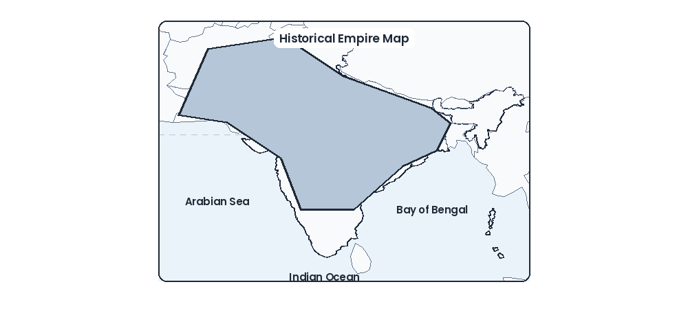
The given map relates to:
Show answer & explanationShow explanation
Answer: (C) Asoka towards close of his reign
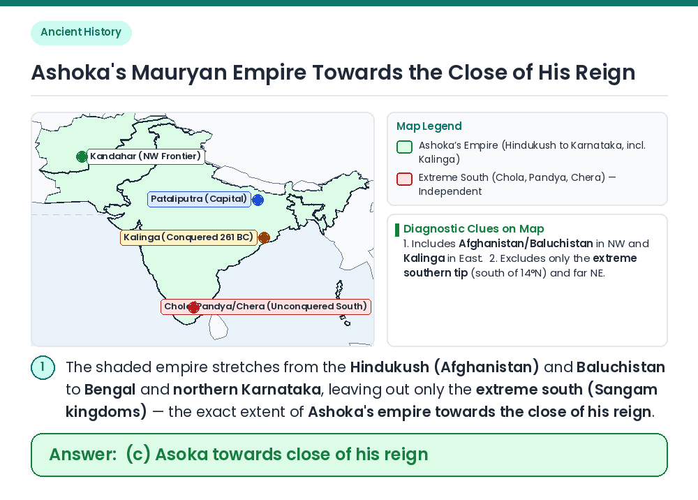
Given / Concept: Examine the boundaries of the shaded empire: it covers almost the entire Indian subcontinent from the Hindukush (Kandahar/Kabul) in the northwest to Bengal and Kalinga in the east, and down to the Chitaldurg/Nellore line (~14°N) in the south, excluding only the extreme southern tip (Tamilakam) and Assam. Compare Rulers: Kanishka's empire extended deep into Central Asia (Tarim Basin) but not into the Deccan/South India; Harsha's empire was confined to North India north of the Narmada; Samudragupta did not rule Afghanistan/Baluchistan directly. Match Ashoka: Only Emperor Ashoka's Mauryan Empire (after the conquest of Kalinga in 261 BC) matched this exact Pan-Indian extent while leaving the friendly Sangam states (Chola, Pandya, Keralaputra, Satiyaputra) independent in the extreme south. Result: The given map relates to Asoka towards the close of his reign. Related Facts: • Southernmost Ashokan Edicts: Found at Brahmagiri, Siddapura, Jatinga-Rameshwara, Maski, Nittur, Udegolam (Karnataka) and Yerragudi, Rajula-Mandagiri (Andhra Pradesh). • Northwesternmost Edicts: Greek and Aramaic inscriptions of Ashoka found at Kandahar (Shar-i-Kuna) and Lampaka (Laghman) in Afghanistan. Correct Answer: (c) Asoka towards close of his reign